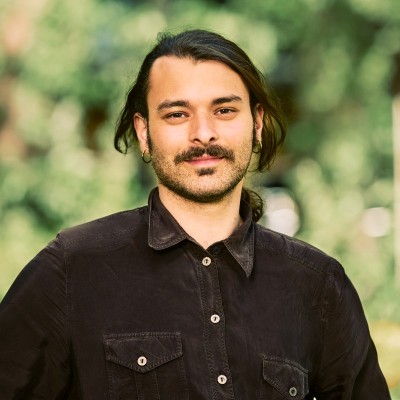
Federico Ferlito
Full-Stack Geospatial Data Engineer
Bilbao, Autonomous Community of the Basque Country, Spain



Summary
👤
Senior🎓
Top SchoolFederico Ferlito is a Full-Stack Geospatial Data Engineer with nine years of experience building ML-driven remote sensing and computer vision solutions for environmental and conservation projects. He blends hands-on expertise in satellite and drone imagery, LiDAR, and geospatial workflows with cloud-native ML deployment on GCP and Azure to deliver scalable carbon baseline and biodiversity monitoring tools. As a founder and senior engineer he has led cross-disciplinary teams to turn research-grade models into production dashboards and mobile apps that inform tree-planting and species identification efforts. His background in AI (MSc, University of Groningen) and early work in NLP and Android EO apps give him a rare mix of language, mobile, and geospatial skills. Based in Bilbao, he’s focused on practical, nature-based solutions and often experiments with integrating emerging tools like OpenAI into remote sensing pipelines.
 9 years of coding experience
 5 years of employment as a software developer
 Master of Science - MS, Artificial Intelligence, Master of Science - MS, Artificial Intelligence at University of Groningen
 Italian, English, Dutch, Spanish, Greek
Github Skills (72)
python10
deep-learning10
nlp10
natural-language-processing10
pytorch10
machine-learning10
sequence10
ctc9
transformer9
transformers9
language-model9
sequence-to-sequence9
facebook9
bert9
speech-recognition9
Programming languages (4)
Github contributions (5)
fferlito/Raytracer
Mar 2018 - Mar 2018
Contributions:28 commits, 21 pushes, 1 branch in 1 day
fferlito/Cat-faces-dataset
Jun 2019 - Jun 2019
Dataset containing around 30K images of cats faces. (useful for training GANs)
Contributions:16 commits, 14 pushes, 1 branch in 24 days
pytorchdeep-learningdatasetgenerative-adversarial-networktraining
Find and Hire Top DevelopersWe’ve analyzed the programming source code of over 60 million software developers on GitHub and scored them by 50,000 skills. Sign-up on Prog,AI to search for software developers.