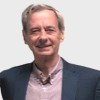
Gustavo Bonorino
Senior Consultant at CONICET
Key Biscayne, Florida, United States



Summary
👤
Senior🎓
Top SchoolGustavo Bonorino is a senior consultant and seasoned earth scientist with over four decades of research and applied experience in sedimentology, geohazards, and spatial modeling. He combines deep domain expertise from positions at CONICET and international institutions with hands-on proficiency in GIS and remote sensing tools (ArcInfo, GRASS, SAGA, QGIS) to preprocess satellite data for mathematical risk models like RUSLE, HEC-HMS, SELENA and CRISIS. His early work at USGS modeling post-fire erosion reflects a long track record of translating field and satellite observations into actionable hazard assessments. Gustavo has also channeled his experience into extensive teaching and course development, making complex GIS and remote-sensing workflows accessible to practitioners. Based in Key Biscayne, Florida, he brings a rare blend of academic rigor (PhD in Sedimentology) and practical consulting experience focused on improving model inputs through vegetation, soil and agricultural process understanding. An understated strength is his ability to bridge disciplinary vocabularies—soil science, agronomy and geomatics—to produce more reliable risk and erosion forecasts.
 4 years of coding experience
 Doctor of Philosophy (Ph.D.), Sedimentology, Doctor of Philosophy (Ph.D.), Sedimentology at McMaster UniversityGrado, Geological and Earth Sciences/Geosciences, Grado, Geological and Earth Sciences/Geosciences at Universidad de Buenos AiresBachiller, Bachiller at Colegio Nacional de Buenos Aires
 French, English
Github contributions (5)

gbonorino/PythonIntegral
Oct 2021 - Nov 2021
Contributions:146 commits, 145 pushes, 1 branch in 10 days
gbonorino/Chatbot
Oct 2024 - Oct 2024
Contributions:76 pushes, 1 branch in 3 days
Find and Hire Top DevelopersWe’ve analyzed the programming source code of over 60 million software developers on GitHub and scored them by 50,000 skills. Sign-up on Prog,AI to search for software developers.