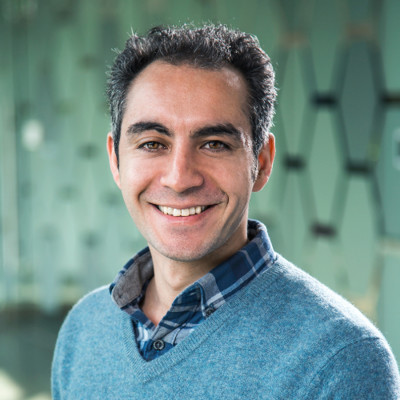
Mehran Ghandehari
Principal Data Scientist (Geospatial Imagery)
Williamsburg, Virginia, United States



Summary
👤
Senior🎓
Top SchoolMehran Ghandehari is a Principal Data Scientist specializing in geospatial imagery and GeoAI, with over 15 years of experience across industry, academia, and applied research. He builds and deploys scalable computer vision and spatiotemporal models to extract actionable property and risk insights from aerial imagery, currently leading imagery analytics at LexisNexis Risk Solutions. Holding a PhD in GIScience, he blends deep learning with open-source geospatial tooling to streamline workflows and move research prototypes into production. Mehran’s background spans technical leadership roles in land governance and academic research, and his public presence (GitHub, publications, and Google Scholar) reflects sustained contributions to GIScience beyond immediate product work. He is known for combining rigorous spatial science with practical engineering to solve large-scale imagery problems.
 11 years of coding experience
 7 years of employment as a software developer
 High School Diploma and Preuniversty Physics and Mathematics, High School Diploma and Preuniversty Physics and Mathematics at Salamatian High SchoolMaster of Science (MSc) Geographic Information System (GIS), Master of Science (MSc) Geographic Information System (GIS) at University of TehranDoctor of Philosophy (PhD) GIScience, Doctor of Philosophy (PhD) GIScience at University of Colorado BoulderBachelor of Science (BSc) Surveying Engineering (Geomatics), Bachelor of Science (BSc) Surveying Engineering (Geomatics) at University of Isfahan
 English, Persian
Github Skills (144)
hub10
python10
emotion-recognition10
gdal10
deep-learning10
instance-segmentation10
tflite10
yolov710
face10
yolov510
onnx10
yolov810
rasterio10
face-recognition10
object-detection10
Programming languages (7)
Github contributions (5)
mehran66/MSc-thesis
Jul 2018 - Oct 2020
A Voronoi-base Algorithm for Medial Axis Extraction (Case Study: Watershed Delineation from River Networks)
Contributions:12 commits, 2 PRs, 8 pushes in 2 years 3 months
axisextractionrivervoronoiwatershed
mehran66/delaunay-triangulation
Jul 2018 - Oct 2020
Contributions:6 commits, 5 pushes, 1 branch in 2 years 3 months
Find and Hire Top DevelopersWe’ve analyzed the programming source code of over 60 million software developers on GitHub and scored them by 50,000 skills. Sign-up on Prog,AI to search for software developers.