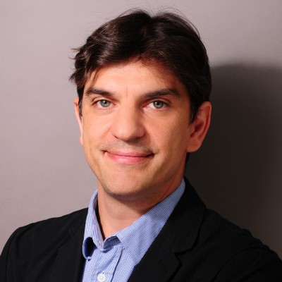
Philipp Gärtner
Research Associate
Berlin, Germany


Summary
👤
Senior🎓
Top SchoolPhilipp Gärtner is a research-focused geospatial scientist with 11 years of experience applying remote sensing and GIS to vegetation and landscape analysis, currently studying forest dynamics in Argentina’s Gran Chaco using Landsat time series and Google Earth Engine. His career spans academic and government research roles across Europe, Australia, and Argentina, blending multitemporal vegetation mapping, object-based image analysis, and synthetic image creation with practical spatial data infrastructure skills. At the German Environment Agency and prior roles at TU Berlin, ZALF and Universidad Nacional de Tucumán he has translated satellite data (WorldView-2, RapidEye, Landsat) into actionable environmental insights. Trained in geo-information and forestry (Wageningen, Eberswalde), he combines ecological domain knowledge with strong technical fluency in remote sensing workflows—a profile that often bridges academic research and operational environmental monitoring.
 11 years of coding experience
 9 years of employment as a software developer
 Msc., International Forest Ecosystem IT, Msc., International Forest Ecosystem IT at Fachhochschule EberswaldeMsc., Geo-Information, Msc., Geo-Information at Wageningen University & Research
 English, Spanish, German

Github Skills (43)
google-earth-engine10
earth-engine10
hugo-theme9
syntax-highlighting9
responsive8
hugo8
webmap6
r-package6
spectral5
static-site-generator5
blogdown5
qgis4
leaflet4
r4
css4
Programming languages (7)
Github contributions (5)
philippgaertner/awesome-earth-engine-apps
May 2021 - Nov 2021
A collection of all public Google Earth Engine Apps.
Contributions:92 commits, 53 pushes, 1 branch in 5 months
google-earth-engineearth-engineapps
philippgaertner/ee-appshot-info
Jan 2022 - Jan 2022
Contributions:7 commits, 4 pushes, 1 branch in 1 day
Find and Hire Top DevelopersWe’ve analyzed the programming source code of over 60 million software developers on GitHub and scored them by 50,000 skills. Sign-up on Prog,AI to search for software developers.